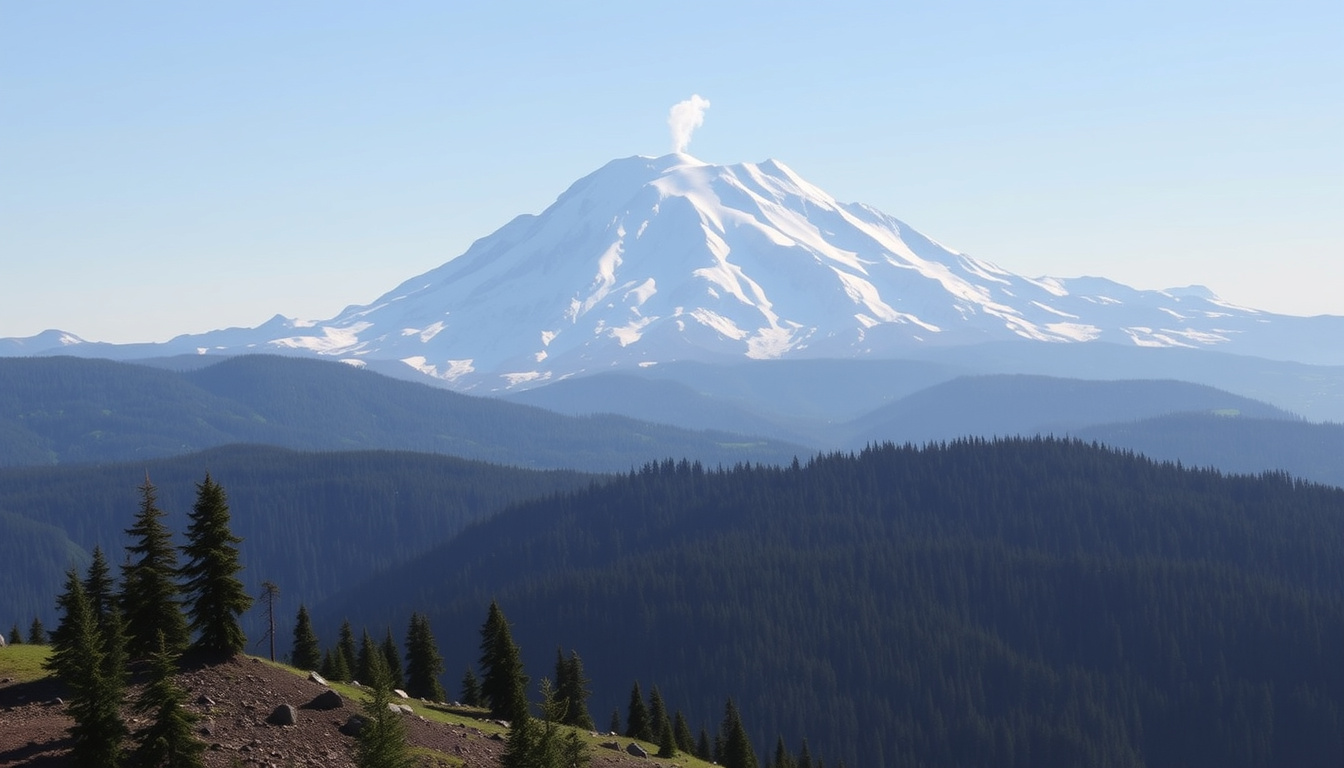
There’s a mountain that dominates the Seattle skyline, but few realize it’s one of the most dangerous volcanoes in the country. Mount Rainier stands 14,410 feet tall, glaciated and quiet — but beneath the beauty lies a serious threat to millions of residents.
Height: 14,410 feet (4,392 meters) ·
Last eruption: August 1894 ·
Glaciers: 25 major glaciers ·
National park established: 1899 ·
Distance from Seattle: Approximately 59 miles (95 km) ·
Risk level: Active volcano, monitored by USGS
Quick snapshot
- Mount Rainier is the most hazardous volcano in the Cascades (National Park Service, the federal agency managing the park)
- Last confirmed eruption in August 1894 (USGS, the U.S. Geological Survey)
- Lahars can reach 100 feet in height and travel 45–50 mph (City of Puyallup, a municipal government in the lahar risk zone)
- The exact date of the next eruption is unknown (National Park Service)
- No authoritative prediction exists for a 2026 eruption (Washington Military Department, state emergency management agency)
- The specific extent of ashfall from a future eruption remains uncertain (USGS)
- 1894 – Last confirmed eruption (National Park Service)
- 1899 – Mount Rainier National Park established (National Park Service)
- 1980 – Mount St. Helens eruption renews focus on Cascade volcanoes (Washington Military Department)
- 2014 – USGS reports Mount Rainier as one of the most dangerous U.S. volcanoes (USGS)
- Continuous monitoring by the Cascades Volcano Observatory (National Park Service)
- Lahar evacuation plans are in place for at-risk communities (City of Puyallup)
- Visitors should check NPS alerts before traveling (Mount Rainier Visitor Guide)
A quick look at the key numbers: six metrics that define Mount Rainier’s profile.
| Label | Value |
|---|---|
| Elevation | 14,410 feet (4,392 m) |
| Last eruption | August 1894 |
| Mount Rainier National Park established | March 2, 1899 |
| Number of glaciers | 25 |
| Distance from Seattle | 59 miles (95 km) |
| Primary hazard | Lahars (volcanic mudflows) |
What is so special about Mt. Rainier?
Glaciated peak and river source
- Mount Rainier is the most glaciated peak in the contiguous United States, with 25 named glaciers (National Park Service, the federal agency managing the park).
- Its meltwater feeds five major rivers: the Carbon, Puyallup, Nisqually, Cowlitz, and White (National Park Service).
Subalpine wildflower meadows
- Paradise, at 5,400 feet, is famous for its summer wildflower displays, drawing over half a million visitors annually (National Park Service).
National park status and history
- Established in 1899, Mount Rainier National Park spans 236,381 acres and was the fifth national park in the United States (National Park Service).
The same glaciers that make Rainier a climbing Mecca also feed the lahar pathways that threaten 80,000 people in the river valleys below.
The implication: Mount Rainier’s dual identity as wilderness icon and active volcano demands respect from everyone who lives near or visits it.
When was the last time Mount Rainier erupted?
Eruption of August 1894
- The last confirmed eruption produced ash columns that reached more than 15 miles (24 km) high, according to USGS (the U.S. Geological Survey volcano monitoring agency).
- Steam emissions were recorded in 1895 but no major lava flow followed (National Park Service).
Recent volcanic activity and monitoring
- Today, the Cascades Volcano Observatory tracks seismic activity, gas emissions, and ground deformation around Mount Rainier (Washington Military Department, state emergency management).
- The volcano is considered active, with periodic small earthquakes (National Park Service).
USGS volcano alert levels
- The USGS uses a four-tier system: Normal, Advisory, Watch, and Warning. At present, Mount Rainier is at Normal (Washington Military Department).
The pattern: Long dormancy can breed complacency, but the lahar hazard is independent of eruption frequency — debris flows can happen anytime.
What areas are at risk if Mount Rainier erupts?
Lahars (volcanic mudflows) and their reach
- Lahars are the primary hazard — these fast-moving slurries of volcanic debris and water can reach 100 feet high and travel 45–50 mph (City of Puyallup, a municipal government in the hazard zone).
- They follow river valleys, meaning communities along the Puyallup, Carbon, Nisqually, and White rivers are directly exposed (National Park Service).
Puyallup and Nisqually river valleys
- The city of Puyallup, population about 44,000, lies directly in a mapped lahar pathway (City of Puyallup).
- Other at-risk communities include Orting, Sumner, and areas of Tacoma (City of Puyallup).
Tacoma and Seattle metropolitan areas
- Approximately 80,000 people live in areas at risk of lahars, but the entire Seattle–Tacoma metro area, home to over 3.3 million, could face ashfall and secondary effects (National Park Service).
- Ash columns rising above 15 miles could deposit ash over hundreds of square miles, disrupting air travel and water supplies (USGS).
The trade-off: Mount Rainier’s breathtaking riverside communities are also its most vulnerable — location is everything.
Which is bigger, Mt. Rainier or Mt. St. Helens?
Two giants of the Cascades, but their threats differ sharply. Here’s how they stack up.
| Metric | Mount Rainier | Mount St. Helens |
|---|---|---|
| Elevation | 14,410 ft (4,392 m) | 8,363 ft (2,549 m) |
| Last confirmed eruption | August 1894 | 1980 (major), with ongoing dome growth |
| Number of glaciers | 25 | ~12 (reduced after 1980 eruption) |
| Primary hazard | Lahars (mudflows) | Eruptions (ash, pyroclastic flows, lahars) |
| Population in hazard zones | ~80,000+ (lahar pathways) | ~20,000 (near monument) |
| Monitoring status | USGS CVO (Normal advisory) | USGS CVO (Normal advisory with periodic unrest) |
Elevation comparison
- Mount Rainier is taller by more than 6,000 feet — it dominates the Cascade skyline (National Park Service).
Volcanic size and prominence
- Rainier has a larger volume (estimated 1.2 cubic miles) and far more glacial ice, which amplifies lahar potential (USGS).
Impact of the 1980 eruption on St. Helens
- Mount St. Helens’ 1980 eruption removed 1,300 feet of its summit and created a massive crater, making it far more active in recent history (US Forest Service).
The catch: bigness cuts both ways — Rainier’s size and ice make it a lahar machine, while St. Helens’ activity keeps public awareness high.
Technical specifications of Mount Rainier
Eight specs that define the mountain’s physical and operational profile.
| Specification | Value |
|---|---|
| Volcano type | Active stratovolcano |
| Elevation | 14,410 ft (4,392 m) |
| Location | Cascade Range, Washington, USA |
| Coordinates | 46.852°N, 121.760°W |
| Number of glaciers | 25 named glaciers |
| National park area | 236,381 acres (1899) |
| Monitoring agency | USGS Cascades Volcano Observatory |
| Primary volcanic hazard | Lahars (volcanic mudflows) |
Who is at risk if Mt. Rainier erupts?
Residents in lahar hazard zones
- Approximately 80,000 people live in mapped lahar hazard zones (National Park Service).
- Communities in the Puyallup, Carbon, and Nisqually river valleys are the most exposed (City of Puyallup).
Visitors and climbers in the national park
- Over 1.5 million people visit the park annually, with thousands attempting summit climbs each year (National Park Service).
- In an eruption or lahar event, climbers on the mountain would face immediate danger from debris and ash (USGS).
Aviation and air quality impacts
- Ash columns reaching over 15 miles would disrupt air travel across the Pacific Northwest (USGS).
- Ashfall could contaminate water supplies and require mask-wearing outdoors (USGS).
What this means: for residents of Orting, Puyallup, and Sumner, a lahar warning is a run signal, not a watch-and-see.
What will happen if Mount Rainier erupts?
Lahar generation and speed
- Lahars triggered by an eruption or even a debris flow without eruption can reach 45–50 mph and be 100 feet deep (City of Puyallup).
- They will follow river valleys, inundating low-lying areas within minutes to hours (City of Puyallup).
Ashfall and tephra distribution
- Mount Rainier’s ash plume could reach heights of more than 15 miles, distributing ash across several states (USGS).
- The USGS advises staying indoors with windows closed and using an N95 mask if going outside.
Evacuation plans and emergency response
- The Washington State Emergency Management Division has developed lahar evacuation routes for each at-risk community (City of Puyallup).
- If an alert is issued, people should leave immediately and not return until officials say it is safe (USGS).
Why this matters: the window for evacuation could be as short as 15–30 minutes. Pre‑planning isn’t optional.
Timeline: Key events in Mount Rainier’s history
- – Last confirmed volcanic eruption (National Park Service)
- – Mount Rainier National Park established (National Park Service)
- – Mount St. Helens eruption renews focus on Cascade volcanoes including Rainier (Washington Military Department)
- – USGS publishes hazard assessment naming Rainier one of the most dangerous volcanoes in the U.S. (USGS)
- – Ongoing monitoring by USGS Cascades Volcano Observatory continues; no imminent eruption warning (Washington Military Department)
What experts say
“Mount Rainier is the most hazardous volcano in the Cascades because of its high probability of producing lahars that could inundate populated areas.”
— National Park Service (federal agency managing the park)
“If an alert is issued, leave the area immediately. Do not return until officials say it is safe.”
— USGS (U.S. Geological Survey volcano hazard handout)
“Mount Rainier and Mount St. Helens are among the top five most dangerous volcanoes in the United States.”
— Washington Military Department (state emergency management agency)
What we know — and what we don’t
Confirmed facts
- Mount Rainier is an active stratovolcano (National Park Service)
- Last eruption occurred in August 1894 (National Park Service)
- Lahars are the greatest risk to life and property (USGS)
- Evacuation plans exist for at-risk communities (City of Puyallup)
What’s unclear
- The exact timing of the next eruption is unknown (National Park Service)
- Whether a major eruption will occur in 2026 cannot be predicted (Washington Military Department)
- The precise path and speed of a future lahar is scenario-dependent (USGS)
- The full extent of ashfall distribution in a future eruption is uncertain (USGS)
For residents and visitors alike, the message is clear: Mount Rainier is a breathtaking wilderness and a serious hazard. The mountain’s glaciers feed spectacular rivers, but those same valleys are lahar highways. The USGS monitors 24/7, yet the uncertainty of eruption timing means preparation is the only real defense. For anyone living in the Puyallup or Nisqually valleys, the choice is simple: know your evacuation route, or risk being caught off guard.
stateofwatourism.com, facebook.com, npmaps.com, en.wikipedia.org, nps.gov, serc.carleton.edu, en.wikipedia.org
For a detailed breakdown of the volcano’s history and hazards, see the Mount Rainier eruption risk guide.
Frequently asked questions
Is it safe to visit Mount Rainier National Park?
Yes, the park is safe to visit. The USGS maintains constant monitoring, and the current volcano alert level is Normal. Visitors should always check NPS alerts before traveling.
What is the best time of year to climb Mount Rainier?
The typical climbing season is late May through early September, when weather and snow conditions are most stable. Permit reservations are required via the National Park Service.
How long does it take to climb Mount Rainier?
Most climbers take two to three days via the standard Disappointment Cleaver route. Summits are typically attempted before noon to avoid afternoon weather hazards (National Park Service).
What is the elevation gain for the Muir Snowfield climb?
The Muir Snowfield route from Paradise to Camp Muir gains about 4,500 feet over 5.5 miles one way. It is not a technical climb but requires proper gear (National Park Service).
Are there any active volcanic alerts for Mount Rainier?
As of 2025, the alert level is Normal. The Washington Military Department reports that any unusual activity would prompt an information statement or advisory level change (Source).
Can I see Mount Rainier from Seattle?
Yes, on clear days Mount Rainier dominates the Seattle skyline to the southeast. The mountain is about 59 miles away, and its 14,410-foot height makes it visible from most of the Puget Sound region (National Park Service).
What wildlife might I encounter in the park?
Common sightings include black-tailed deer, black bears, mountain goats, and marmots. The park also hosts over 140 bird species. Visitors should maintain safe distance from all wildlife (National Park Service).
Related stories





Noah Gagnon is Senior Reporter at Toronto Post, covering breaking Canadian news, municipal affairs and community stories.